
This Surveillance, monitoring of saline soil distribution from climate change and land use in salt farm area, Nakhon Ratchasima Province
Keywords:
monitoring, saline soil distribution, climate change, land utility, Toong Sam Rit areaAbstract
Abstract
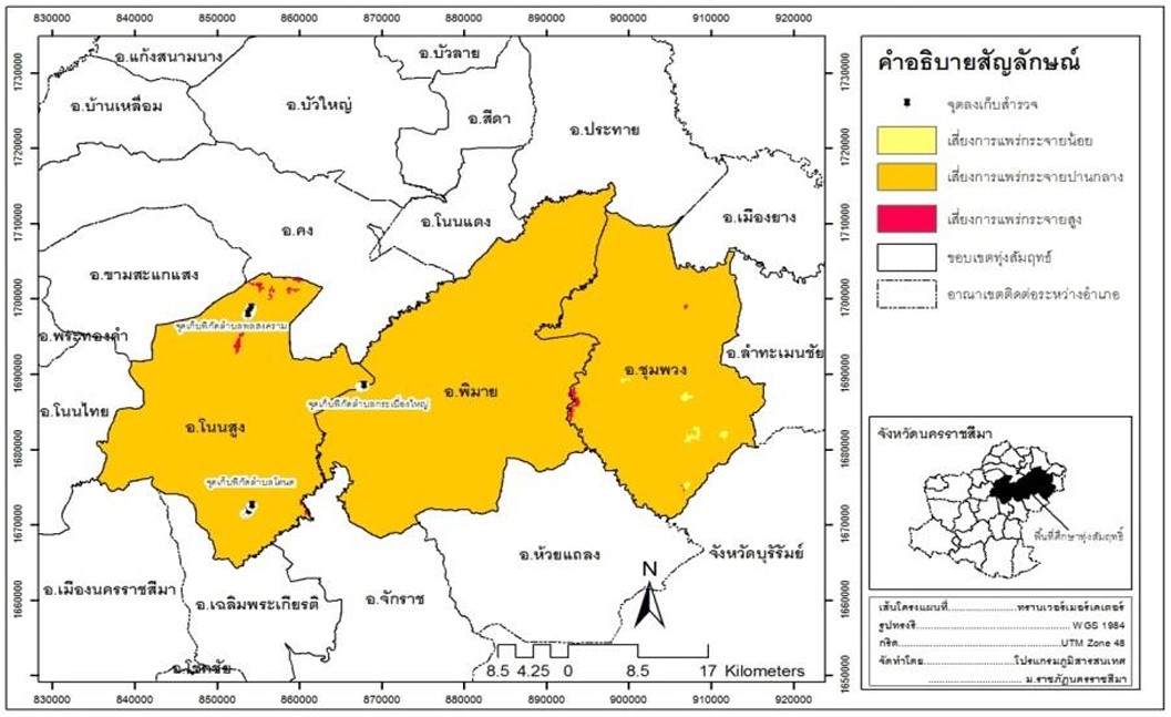
This research aims to develop a model survey monitored changes in soil salinity spreading to nearby salt farm. Environmental factors that influence the level of violence spreading salt. The impact of the spreading salt, arable crops, food analysis and quality assessment of saline soil and water nearby salt farm. The study area is an experiencing saline include Non Sung, Chum Phuang and Phimai district in Nakhon Ratchasima province. There explore how participatory monitoring of the public sector with the geophysical survey participants how to test soil in the field. The study indicated that most areas in the fields of achievement Nakhon Ratchasima the salt was extensive, especially in areas that do not meet the amount of salt in the soil, much of the area is land use, land use, making crops paddy in 2007. Decline of the year in 2000 was 1,662,844 rai of cassava and sugarcane in 2007. Decline of the year in 2000 was 108,119 rai of rice and salt in 2007. Decline of the year in 2000 was 1,197,970.71 rai of nature the movement of salt and three points that salt farm in Ta Nod sub-district and Phon Songkram sub-district of Non Sung district, a movement similar to the style top soil is sandy soil sediment. The low density of the salt soil are moving faster than the salt farm in Phimai district. Because of the top soil is clay, a dense layer of salt, making relatively stable.
Keywords: monitoring, saline soil distribution, climate change, land utility, Toong Sam Rit area
Downloads
References
กรมพัฒนาที่ดิน. (2545). การประเมินการสูญเสียดินในประเทศไทย. กรมพัฒนาที่ดิน กระทรวงเกษตรและสหกรณ์ กรุงเทพฯ.
กรมทรัพยากรธรณี. (2550). การพัฒนาพื้นที่ดินเค็มในภาคตะวันออกเฉียงเหนือ. ส่วนมาตรฐานทรัพยากรแร่ สำนักทรัพยากรแร่ กระทรวงทรัพยากรธรรมชาติและสิ่งแวดล้อม. กรุงเทพฯ.
จริยา ฐิติเวศน์ (2556). โครงการการประเมินและวิเคราะห์แนวโน้มความเสี่ยงของพื้นที่ศึกษานำร่องในบริบทของจังหวัดต่อสภาพอากาศแปรปรวนและการเปลี่ยนแปลงภูมิอากาศเพื่อจัดทำกรอบการศึกษาด้านการปรับตัวต่อภูมิอากาศแบบบูรณาการเชิงพื้นที่แบบองค์รวม, รายงานวิจัยฉบับสมบูรณ์. สำนักงานคณะกรรมการส่งเสริมวิทยาศาสตร์ วิจัยและนวัตกรรม.
ลักษณ์นารา ขวัญชุม. (2561). การประยุกต์ใช้ระบบสารสนเทศภูมิศาสตร์เพื่อศึกษาการแพร่กระจายดินเค็ม บริเวณตำบลพลสงคราม อำเภอโนนสูง จังหวัดนครราชสีมา. วารสารแก่นเกษตร (ฉบับพิเศษ ), 1, 1181-1187.
Downloads
Published
How to Cite
Issue
Section
License
Copyright (c) 2024 Nakhon Ratchasima Rajabhat University

This work is licensed under a Creative Commons Attribution-NonCommercial-NoDerivatives 4.0 International License.